


fgh

brandy
User
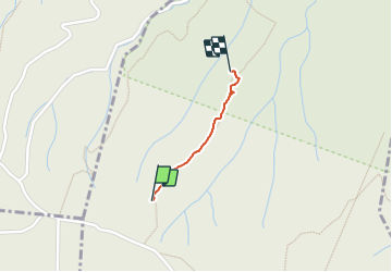

Length
582 m

Max alt
389 m

Uphill gradient
0 m
Km-Effort
791 m

Min alt
317 m

Downhill gradient
63 m
Boucle
No
Creation date :
2024-01-14 12:50:00.471
Updated on :
2024-01-15 18:36:30.224
10m
Difficulty : Easy

FREE GPS app for hiking
 SityTrail
IGN / Geographical institutes
SityTrail Plus
The world is yours!
About
Trail Walking of 582 m to be discovered at Occitania, Gard, Le Garn. This trail is proposed by brandy.

Positioning
Country:
France
Region :
Occitania
Department/Province :
Gard
Municipality :
Le Garn
Location:
Unknown
Start:(Dec)
Start:(UTM)
615952 ; 4910073 (31T) N.
Comments